What Happened
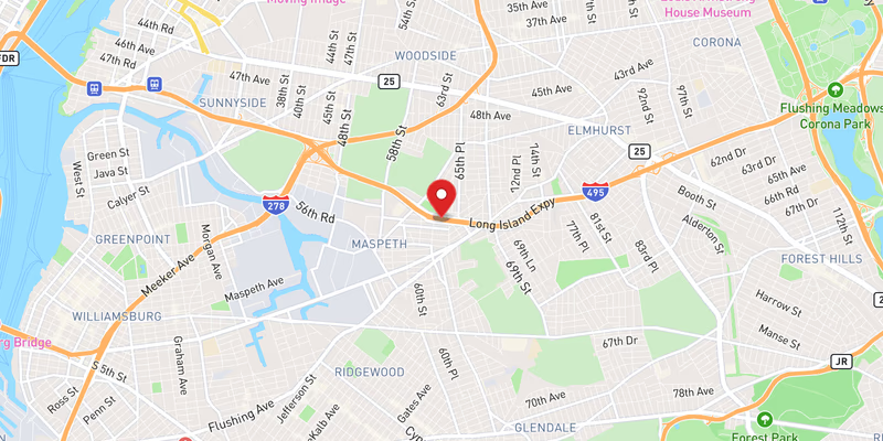
Flooding on the eastbound Long Island Expressway blocked three left lanes in Queens County on Saturday, July 18, 2026, snarling traffic along one of the New York metro area’s most heavily traveled corridors. The incident was logged as minor in severity, though the lane blockage affected a significant portion of the roadway’s capacity during what proved to be an unusually active day for incidents on I-495.
No injuries or vehicle collisions were reported in connection with this specific flooding event. The standing water was sufficient to force the closure of three left lanes in the eastbound direction, redirecting traffic to the remaining right-side lanes and compressing the flow of vehicles heading toward Nassau County and Long Island’s interior.
The precise mile marker and nearest exit were not confirmed in the initial incident report. Police have not yet confirmed the exact stretch of Queens where the water accumulation was most severe.
Location & Road Context
The Long Island Expressway (I-495) is the primary east-west artery connecting Midtown Manhattan with the heart of Long Island, passing through Queens before crossing into Nassau and Suffolk counties. The Queens segment of the LIE carries some of the highest traffic volumes of any roadway on Long Island, making even minor lane reductions capable of producing significant backups, particularly on summer weekends when beach and recreational traffic peaks.
Our database records 1,749 incidents on I-495 and 171 accidents in Queens County — figures that underscore the corridor’s vulnerability during weather events. The July 18 flooding was far from isolated: the same day saw at least two additional flooding events on I-495 (including a moderate-severity flooding incident) alongside multiple crashes, including incidents logged at 38344826, 38344750, and 38344573. Separately, planned overnight closures on the LIE and Sunrise Highway were also announced for the coming week, signaling continued disruptions along the corridor.
Broader Impact
The clustering of flooding events and crashes on I-495 within a single afternoon points to deteriorating surface conditions across the expressway during the July 18 weather pattern. Motorists encountering standing water on high-speed limited-access highways face a heightened hydroplaning risk even at posted speeds, and lane blockages that push traffic rightward can compress merging zones where secondary collisions are more likely. Drivers navigating the LIE during summer storm events are advised to check real-time conditions via 511NY before entering the Queens segment of the highway.