What Happened
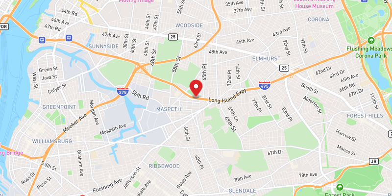
Three right lanes of westbound I-495 in Queens County were blocked Saturday, July 18, 2026, after flooding inundated the roadway, according to incident records. The blockage was rated moderate severity, indicating a meaningful disruption to traffic flow on one of the New York metropolitan area’s busiest commuter corridors.
No injuries or vehicle collisions were reported in connection with this specific flooding event. The lane closures were triggered solely by water accumulation on the travel surface, forcing westbound traffic to merge left and navigate reduced capacity at a stretch of the Long Island Expressway that regularly carries heavy weekend volume.
The July 18 flooding was not an isolated occurrence on the LIE that day. Incident records show a second flooding event on I-495 also logged on the same date, alongside at least two separate crashes on the highway — one minor and one also recorded that afternoon. The concentration of incidents within a single calendar day underscores how quickly conditions can compound on a high-volume route like the LIE when weather plays a factor.
No official statement from the New York State Department of Transportation or other responding agency has been released specifying the precise milepost, the duration of the blockage, or the weather event that triggered the flooding. The source record confirms the westbound direction and the three-lane right-side impact.
Location & Road Context
I-495, the Long Island Expressway, is one of the most heavily traveled interstates in the United States, running roughly 71 miles from the Queens–Midtown Tunnel approach westward through Nassau and Suffolk counties to Riverhead. The Queens segment — where this flooding occurred — sits at the western terminus of the highway and is among its most congested stretches, particularly on weekends when beach and recreational traffic merges with standard commuter flow headed into Manhattan.
Our database has recorded 1,749 incidents on I-495 to date, with 171 incidents logged in Queens County overall. The volume of activity on this corridor — including two crashes on July 18 alone and a second flooding event the same day — reflects the sustained risk profile of this stretch of roadway in wet conditions. Drivers using the LIE westbound should also be aware of upcoming planned overnight closures on the LIE and Sunrise Highway announced for the following week.
Broader Impact
Standing water on interstate lanes poses a hydroplaning risk even at posted highway speeds, and the right-lane concentration of this blockage is consistent with drainage patterns along depressed or lower-grade sections of the LIE in Queens. Drivers approaching the affected area from the Nassau County line should monitor 511NY for real-time lane status before entering the Queens segment, particularly during or after heavy rainfall events.