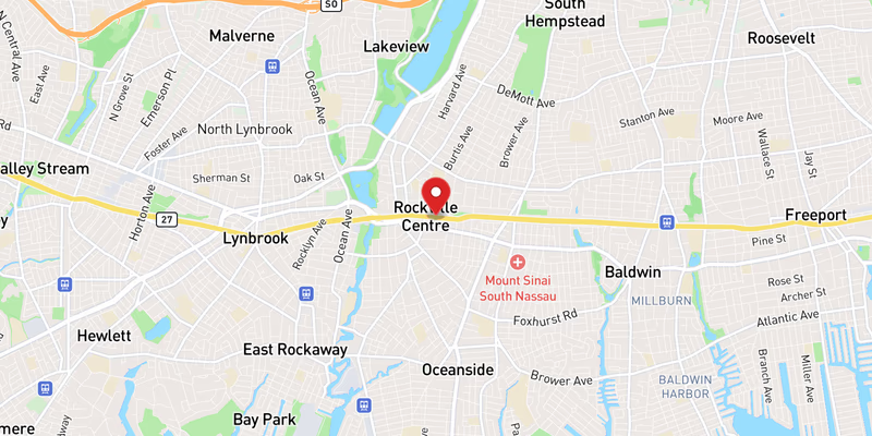
What Happened
A flooding event on eastbound NY 27 in Nassau County closed the roadway’s left lane on Monday, July 6, 2026, creating a moderate-severity disruption for drivers moving through one of Long Island’s most heavily traveled east-west corridors. The incident was logged in traffic monitoring systems and reflects deteriorating road conditions across a broad stretch of Nassau County following what appears to be a significant rain event.
According to the incident record, one lane — specifically the left lane of the eastbound carriageway — was taken out of service due to standing water. Details remain limited as to the precise milepost or cross-street where the flooding accumulated, and police or highway officials have not yet confirmed the depth of the water, the cause of the drainage failure, or whether any motorists became stranded as a result of the conditions.
No injuries have been reported in connection with this particular flooding event, and no vehicles are confirmed disabled in the affected lane at this time. The severity of the incident has been classified as moderate, reflecting the lane closure and the potential for significant traffic backup on a road that carries tens of thousands of vehicles daily. Exact timing of the initial lane closure has not been specified beyond the date of Monday, July 6, 2026.
The flooding on NY 27 did not occur in isolation. July 6, 2026 saw a cluster of flood-related and weather-influenced road incidents across Nassau County, strongly suggesting that a regional storm system or sustained rainfall was responsible for deteriorating pavement conditions. Responding agencies have not yet issued a formal statement attributed to an official spokesperson, and the investigation — to the extent one is ongoing — appears focused on drainage and road-surface management rather than any criminal or collision-related cause.
Motorists who encountered the affected stretch of NY 27 eastbound are advised that conditions may change rapidly in flood situations, and what begins as a partial lane closure can escalate quickly if water levels rise or if a disabled vehicle compounds the obstruction. Drivers are urged to reduce speed significantly when approaching standing water, as the depth of roadway flooding is frequently underestimated from behind the wheel.
Location & Road Context
NY 27 — also known as Sunrise Highway through much of its Nassau County stretch — is among the most critical surface arterials on Long Island, functioning as a primary east-west spine connecting New York City to the South Fork of Suffolk County. The road carries both local commuter traffic and long-distance travel, particularly during summer months when destinations like the Hamptons and Fire Island draw heavy weekend and weekday volume. The NY 27 corridor in Nassau County passes through dense suburban communities, commercial corridors, and lower-lying areas that are historically susceptible to storm-water accumulation.
Our database shows 849 recorded incidents on NY 27, underscoring how consistently active this road is from a traffic and safety standpoint. In Nassau County alone, our records contain 757 accidents and incidents, and July 6, 2026 accounted for a notable cluster of those, with flooding, roadwork, a bridge work closure, and a separate crash all logged on the same date. The concentration of incidents in a single day points to systemic weather stress on the county’s road infrastructure.
Broader Impact
The flooding on NY 27 was one of at least two flood-related lane closures reported in Nassau County on July 6, 2026, with a separate flooding incident on NY 24 and another on Meadowbrook State Parkway logged the same morning. A crash on NY 135 and a crash on I-495 were also recorded, suggesting that wet pavement and reduced visibility were contributing to a dangerous travel environment across multiple major Nassau County corridors simultaneously. Drivers with eastbound travel plans on NY 27 should monitor conditions through 511NY for real-time updates before departing, and should consider alternate routes along the parallel Southern State Parkway or Northern Boulevard if delays compound significantly.
Under New York State law, highway drainage and flood-response responsibilities on state routes like NY 27 generally fall to the New York State Department of Transportation, which coordinates with county officials and emergency services to assess standing water, deploy traffic control resources, and clear lanes as conditions allow. No timeline for full lane restoration has been released as of the time of this report.