What Happened
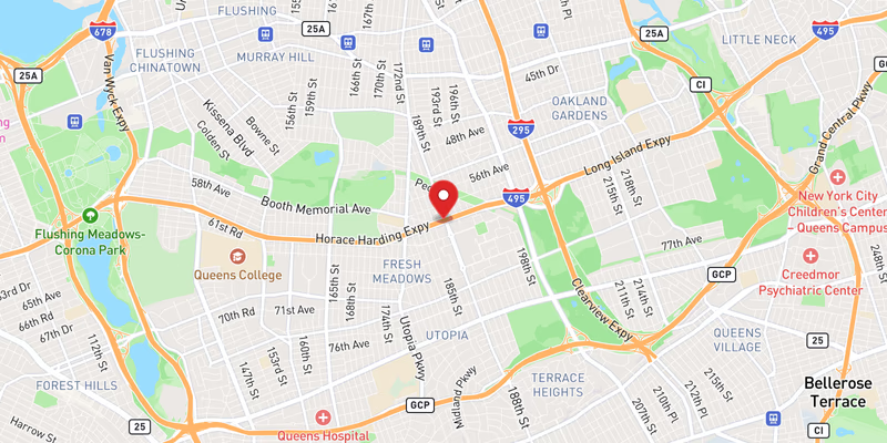
All eastbound lanes of Interstate 495 — the Long Island Expressway — were brought to a complete standstill by flooding in Queens County on Saturday, July 18, 2026. The closure was classified as a major-severity incident, with official records confirming a full lane blockage that left eastbound traffic unable to proceed through the affected stretch.
The flooding on this segment was not an isolated event. At least four additional flooding incidents were recorded on I-495 the same day — some rated major, others moderate — along with a separate crash on the expressway also logged on July 18. The concentration of incidents points to a widespread, acute inundation event along the LIE corridor rather than a localized drainage failure. The precise mile marker, exit reference, or cross-street for this specific closure has not been confirmed in official records.
No injuries or fatalities have been reported in connection with this flooding closure, and no individuals have been named in the incident record. The responding agency and the exact time the lanes were blocked have not been specified in the available official data.
Location & Road Context
Interstate 495 in Queens represents one of the most heavily traveled stretches of roadway on Long Island, serving as the primary eastern gateway out of New York City. The expressway’s Queens segment is particularly vulnerable to surface flooding during heavy rainfall events due to its below-grade design in portions of the corridor and aging drainage infrastructure. Our I-495 incidents page reflects a road with 1,754 recorded incidents in our database — a figure that underscores how consistently this corridor generates traffic emergencies.
The same-day cluster of flooding events — logged across multiple locations along the LIE on July 18 — is consistent with a significant rainfall episode affecting Queens and western Long Island simultaneously. Drivers traveling eastbound that day faced compounding disruptions: this major all-lanes-blocked closure plus at least four other flooding incidents and a separate crash, all documented in our Queens County incident records. Motorists caught in the corridor were effectively navigating a gauntlet of closures with few straightforward alternatives on parallel surface roads.
Broader Impact
Flash flooding that blocks all lanes of a major interstate creates cascading delays that extend well beyond the initial closure point — backup queues on I-495 routinely stretch for miles within minutes of a full blockage. The five documented flooding incidents on the LIE on July 18 suggest that any single alternate route — whether the Grand Central Parkway, Northern Boulevard, or local Queens streets — would have been absorbing diverted traffic simultaneously, compounding surface-level congestion across the borough. Drivers who regularly use the LIE through Queens can monitor real-time conditions and plan around recurring flood-prone segments through our accidents and incidents tracker.