What Happened
Heavy rain swept across Central New Jersey on Tuesday, July 9, 2026, triggering flash flooding that turned roadways into rivers and created dangerous driving conditions during the evening commute, according to News 12 Long Island. Roads were submerged, traffic came to a standstill across multiple municipalities, and officials repeatedly urged drivers to avoid flooded streets as the storm moved through the region.
The Garden State Parkway was among the hardest-hit roadways. Near mile marker 120 northbound in the Keyport area, standing water spread across the highway, forcing drivers to slow to a crawl at the height of the storm. The conditions made travel hazardous for anyone attempting to push through during the commute window, News 12 reported.
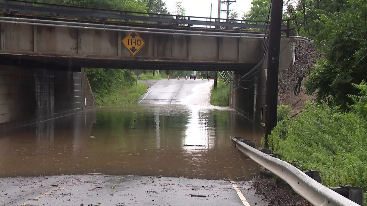
In Edison, floodwaters submerged sections of Route 1. Some drivers carefully navigated through the high water while others drove through at speed, sending large wakes across the roadway — a behavior that can destabilize neighboring vehicles and deepen the danger for all nearby. Just down the road from the main Route 1 flooding, runoff spilled onto Dean’s Lane, sending water rushing beneath an overpass and rendering the road completely impassable. Drivers were forced to turn around as floodwaters fully blocked passage.
In South Brunswick, police officers took an active role in keeping motorists safe, monitoring flooded streets and stopping drivers who ignored road closure barricades and traffic cones. Officers warned motorists to stay off flooded roads and to avoid driving through standing water entirely. The message echoed the broader official guidance issued throughout the storm: “Turn Around, Don’t Drown.” Officials reminded the public that even a small amount of moving water has the force to sweep away a vehicle.
Flooding also impacted Livingston Avenue in North Brunswick, where drivers slowed as they navigated through deep water accumulating on the roadway. In one striking scene captured during the event, a snapping turtle was spotted swimming across the flooded street — a vivid illustration of just how much water had pooled in the area, according to News 12. Officials urged all residents region-wide to remain off the roads unless travel was absolutely necessary.
Location & Road Context
The flooding spread across several distinct communities in Central New Jersey — Keyport, Edison, South Brunswick, and North Brunswick — affecting both major state highways and local roads. The Garden State Parkway is one of New Jersey’s most heavily traveled arteries, and flooding near mile marker 120 northbound placed it squarely in the path of the evening rush. Route 1 in Edison is a critical commercial corridor connecting numerous towns along its length, making any closure or hazard there a significant disruption to thousands of daily commuters and local drivers. Dean’s Lane and Livingston Avenue represent the local road network that absorbs overflow traffic when highways slow — both were rendered dangerous or impassable by Tuesday’s storm.
Broader Impact
Flash flooding of this scale during an evening commute carries heightened risk because drivers already under time pressure are more likely to attempt crossing water-covered roads rather than turning around. The “Turn Around, Don’t Drown” warning issued by officials during Tuesday’s storm reflects data showing that the majority of flood-related vehicle fatalities occur when drivers attempt to cross flooded roadways — with as little as six inches of moving water capable of knocking a person off their feet, and just two feet capable of floating most vehicles. The closure of Dean’s Lane in Edison and the active police enforcement in South Brunswick both illustrate how quickly even secondary roads can become life-threatening during a fast-moving flash flood event.