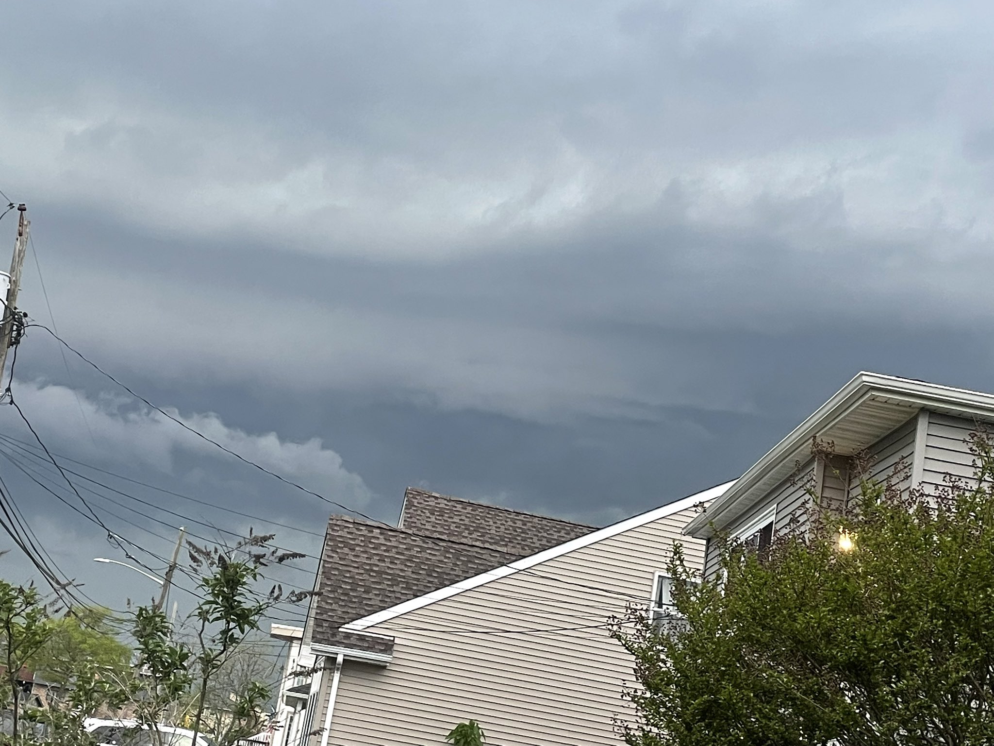
May 20, 2026 — 8:35 PM. The severe thunderstorm that flooded Brooklyn and Queens this evening announced its arrival on Long Island with a rare and dramatic shelf cloud — a low, horizontal, wedge-shaped cloud formation that signals the leading edge of a powerful storm’s outflow boundary.
The Shelf Cloud
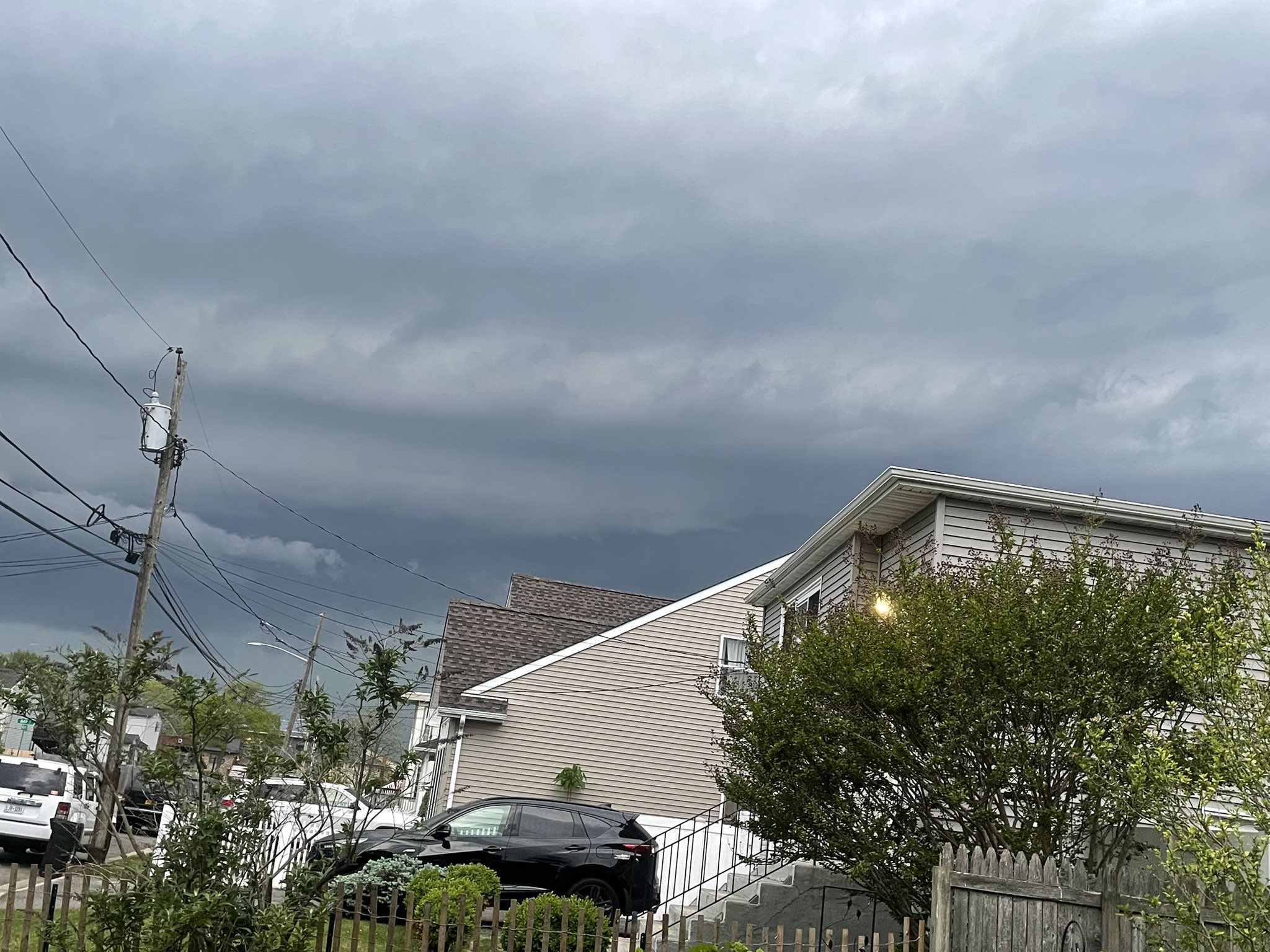
Source: @JRealMedia on X — “Haven’t seen a shelf cloud like this on Long Island probably ever”
What Is a Shelf Cloud?
A shelf cloud (or arcus cloud) forms along the gust front — the leading edge of cold air rushing out from a thunderstorm’s downdraft. When this cold, dense outflow slides beneath the warmer, moist air ahead of the storm, the warm air is forced upward rapidly, condensing into the dramatic wedge-shaped cloud visible in these images.
What a shelf cloud tells you:
- Severe wind is imminent — the gust front that creates the shelf cloud carries the storm’s strongest wind gusts. Tonight’s storm has 60 mph gusts.
- Heavy rain follows within minutes — the shelf cloud marks the boundary between dry air ahead and the storm’s main precipitation core behind it
- The storm is intensifying — well-defined shelf clouds indicate strong, organized thunderstorm cells with sustained updraft/downdraft cycling
- Hail is possible — tonight’s NWS warning includes penny-sized hail
How Rare Is This?
Long Island’s geography — a narrow, flat, 118-mile-long island surrounded by ocean on three sides — doesn’t typically produce the dramatic shelf cloud formations seen in the Midwest, where flat plains and extreme temperature gradients create more photogenic storm structures. When a Long Island resident says “haven’t seen one like this probably ever,” that’s a credible observation — this formation requires an unusually powerful storm cell moving across the island’s flat terrain with the right temperature and humidity conditions.
What’s Happening Now
As of 8:35 PM EDT, this storm cell has crossed from Brooklyn and Queens into western Nassau County and is pushing eastward. Based on the storm path:
| Time | Location | Expected Conditions |
|---|---|---|
| 8:00–8:30 PM | Western Nassau (Hempstead, Garden City, Mineola) | Heavy rain, 50-60 mph gusts, possible hail |
| 8:30–9:00 PM | Central Nassau (Levittown, Massapequa, Farmingdale) | Peak intensity rainfall, flash flooding |
| 9:00–9:30 PM | Nassau/Suffolk border (Melville, Huntington, Babylon) | Heavy rain, diminishing winds |
| 9:30–10:00 PM | Central Suffolk (Brentwood, Islip, Patchogue) | Moderate to heavy rain |
| 10:00 PM+ | Eastern Suffolk | Trailing showers, clearing |
⚠️ The LIE sinkhole at Exit 49 in Melville — repaired just last week after a 10-foot sinkhole swallowed a car — sits directly in this storm’s path. Additional rainfall on recently repaired pavement over a known subsurface weakness is a concern.
Tonight’s Full Storm Coverage
- LaGuardia Sinkhole + Bronx School Bus
- LIE Wrong-Way Driver + DWI Plea
- Dr. Dao Yuan: Four Sinkholes in Seven Days
- Severe Thunderstorm Warning — 60 MPH Winds + Hail
- Queens Flooding — Flushing Avenue Underwater
- Bushwick Flash Flood — Wilson & Stockholm
Storm watch continues through 6 AM Thursday.
Were You Injured?
If you or someone you know was injured during the May 20 storm — whether in a car accident caused by flooding, a slip and fall from downed debris, or property damage from infrastructure failure — you may have a legal claim. Under New York law, claims against a city or county for inadequate emergency response or infrastructure failure must be filed within 90 days under General Municipal Law §50-e. jtnylaw.com offers free consultations for Long Island and NYC accident victims.
📞 (516) 750-0595 — Available 24/7